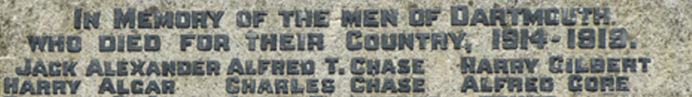
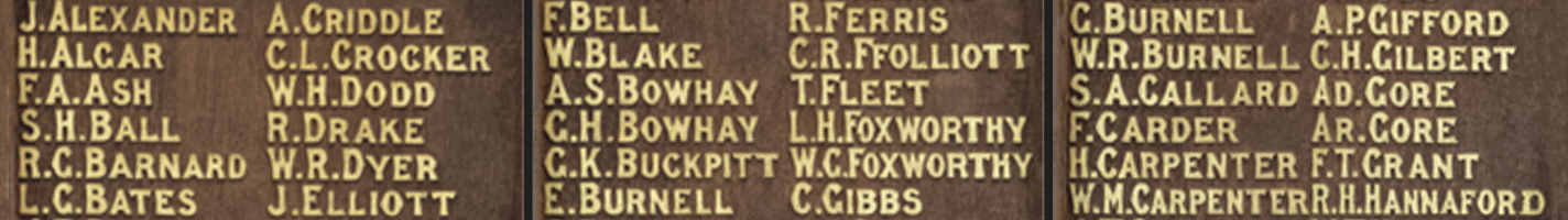
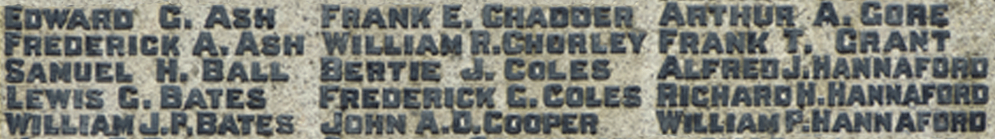
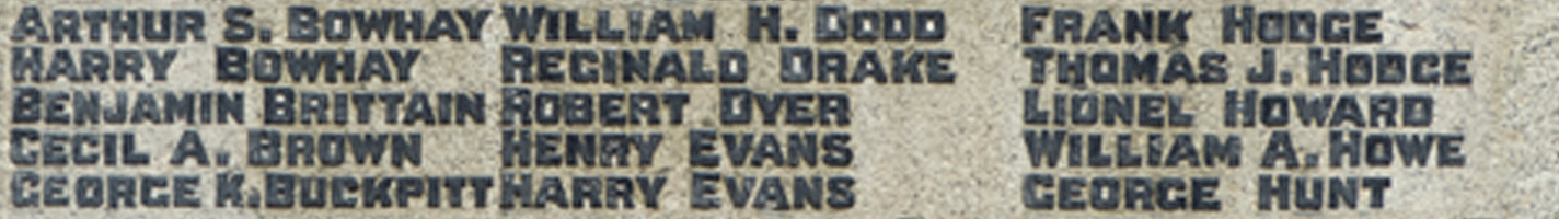
Locating William Percival Hannaford's Original Burial Location
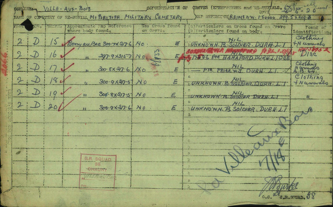
The document below (obtained from the CWGC website in the pages on Percival Hannaford at the Ville aux Bois Cemetery) records that Percival Hannaford's body was "concentrated" into the Ville aux Bois Cemetery from an original burial located at coordinates 297.7 x 215.7. These coordinates represent a distance North and East respectively from an origin point in cental France using the French "Lambert" coordinate system as used during the Great War.
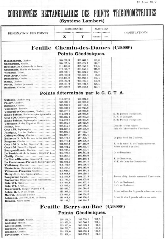
We have been unable to find any images of the maps from which the person who filled out this form read off the Lambert coordinates. However we have found the following French document dated April 1917 which records the Lambert coordinates of a number of nearby surveyed points, including church towers.
Making the assumption that any war-damaged church towers were re-built in their original positions, we can locate the same church towers on Google Maps and identify their coordinates in degrees of latitude and longitude.
The British concentration record gives the position of Percival Hannaford's original burial with a North coordinate (Lambert System) of 297.9. We can identify two church towers in the French survey document with very similar North coordinates: Jumigny Axe du Clocher at 297.9670 and Cuissy-et-Geny Clocher at 297.8454. From these two survey points, we can accurately interpolate the latitude of Percival Hannaford's original burial.
Similarly, the British concentration record gives the position of Percival Hannaford's original burial with an East coordinate (Lambert System) of 215.7. We can identify two church towers in the French survey document with reasonably similar East coordinates: Corbeny Clocher at 216.7567 and Craonne Clocher at 214.2010. From these two survey points, we can accurately interpolate the longitude of Percival Hannaford's original burial.
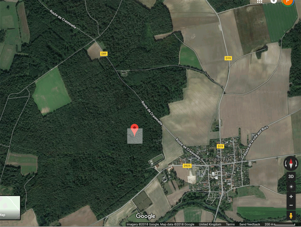
This leads us to calculate that the Lambert coordinates for Percival's original burial in the British concentration record equate to 49.410183° North, 3.809145514° East, as shown in this Google Map.
Click here to download a spreadsheet used to calculate the degrees of latitude and longitude of his original burial position.
Notes on Accuracy
- The French survey coordinates and Google Maps coordinates are all specified to at least 6 significant figures, which in theory is accurate enough to locate a position to within about a metre. In practice, it is highly unlikely that the 1917 French survey was conducted to such a level of accuracy. However this is made irrevelant by the fact that the Britich concentration record gives Percival's burial position to only 4 significant figures - which gives rise to a possible error of about 100 metres.
- The linear method of interpolation here ignores the way that the Lambert coordinate system uses projections that adjust for the curvature of the Earth. However, because the northings and eastings used in these interpolations are all within a fuw hundred meters of each other of each other, this error is small - much smaller than the error due to the fact that the British concentration forms only use 4 significant figures.
Taking all these factors into account, we conclude that Percivals' original burial was probably within the shaded square shown below; hence our conclusion that it was "located in a wooded area a little way to the north west of the village of Pontavert".